
MTCOM: 5G Orchestration for Drone Monitoring
The MTCOM, led by SMA-RTY, is a project focused on developing a coastal monitoring system in the Port of La Spezia. Leveraging 5G connectivity, MTCOM enables real-time monitoring of maritime drones (USVs – Unmanned Surface Vehicles), enhancing situational awareness along the coast.
The project brings together several partners, each contributing specific expertise: Infocom, Edgelab, Sitep, and the University of Genoa.
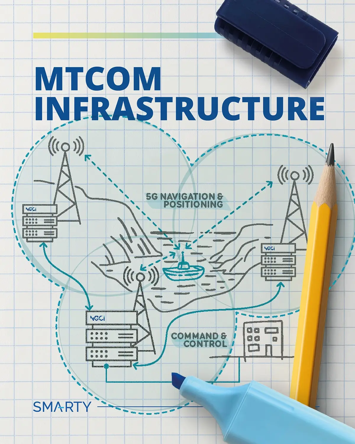
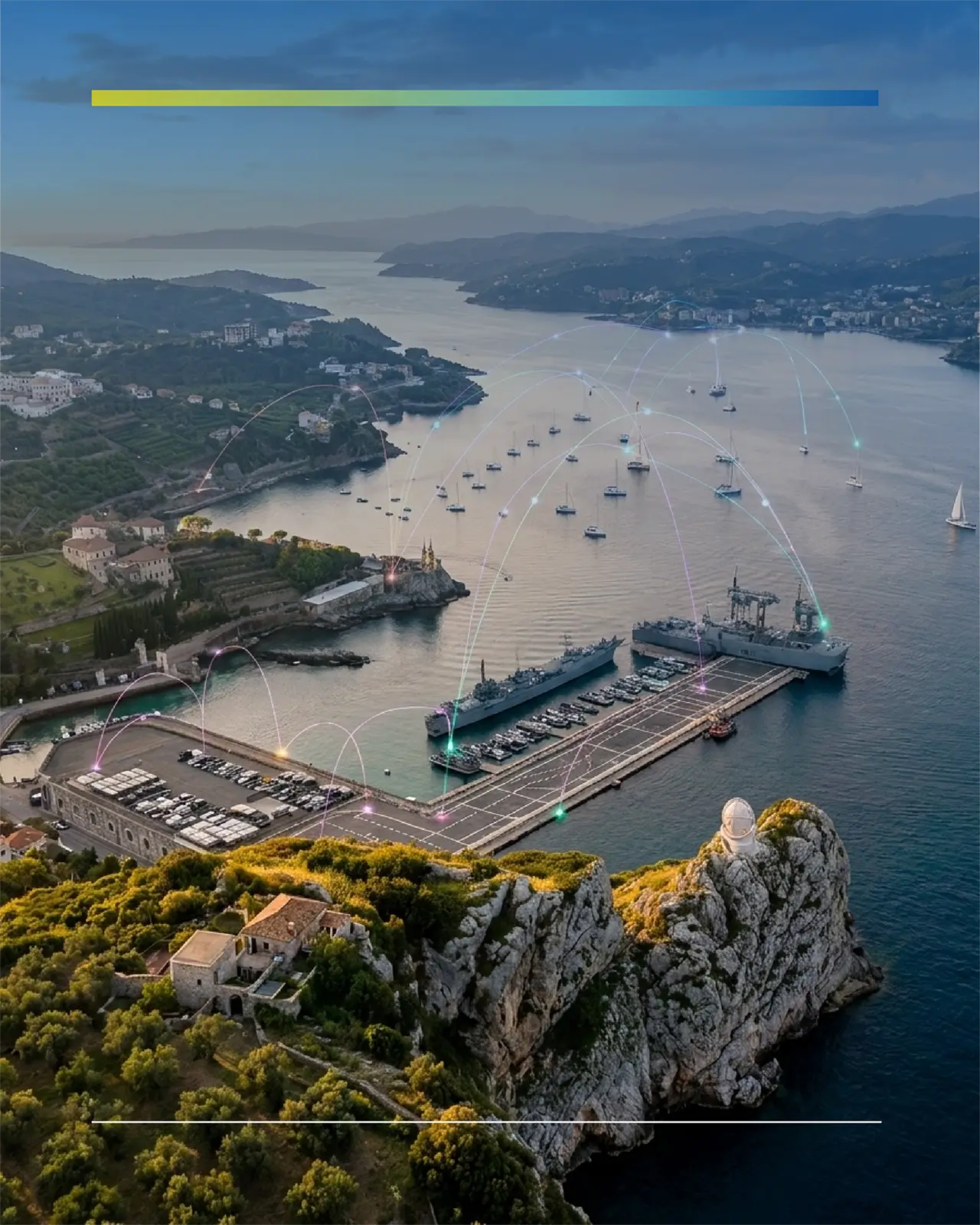
After exploring the role of the University of Genoa and its research on signal behaviour at sea, we now turn to Infocom. Together with Maurizio Giribaldi, Technical Manager, we explored how their contribution helped bridge infrastructure, applications, and communication services within the MTCOM ecosystem.

Who are you and what does Infocom do?
Infocom is a small company with strong roots in the academic environment. We provide consultancy and technical support in the field of Information and Communication Technologies, with a particular focus on telecommunications and software systems.
Our activities range from software development and validation to supporting research and innovation projects, often in collaboration with universities and industrial partners. Over time, we have built solid expertise in areas such as cloud computing, virtualization, and distributed systems.
In practice, we help organizations design, deploy, and manage complex digital infrastructures, especially when there is a strong integration between software, networking, and advanced technologies.
How did you get in touch with SMA-RTY, and what was your initial role in the project?
We got in touch with SMA-RTY through the University of Genoa, with whom we have an ongoing collaboration. We often work closely with academic partners, both for research activities and for accessing advanced technical expertise.
SMA-RTY was looking for someone who could focus on the upper layer of the infrastructure, allowing them to concentrate on the 5G network itself. They asked the University of Genoa for a suitable partner, and here we are!
Why did Infocom decide to participate in MTCOM?
As a small company, we strongly value collaboration between organizations like ours, combining our specific expertise to create broader opportunities and address more complex challenges together. In fact, we are also part of a network of companies based in Genoa focused on ICT technologies for territory monitoring and security.
So MTCOM perfectly fits into this context. It gave us the opportunity to explore these topics in a concrete application scenario, starting from environmental monitoring in a maritime context.
For us, it was not just about participating in a single project, but about strengthening collaboration within this ecosystem and applying our competencies in a meaningful and realistic use case.
What did your work in the project consist of?
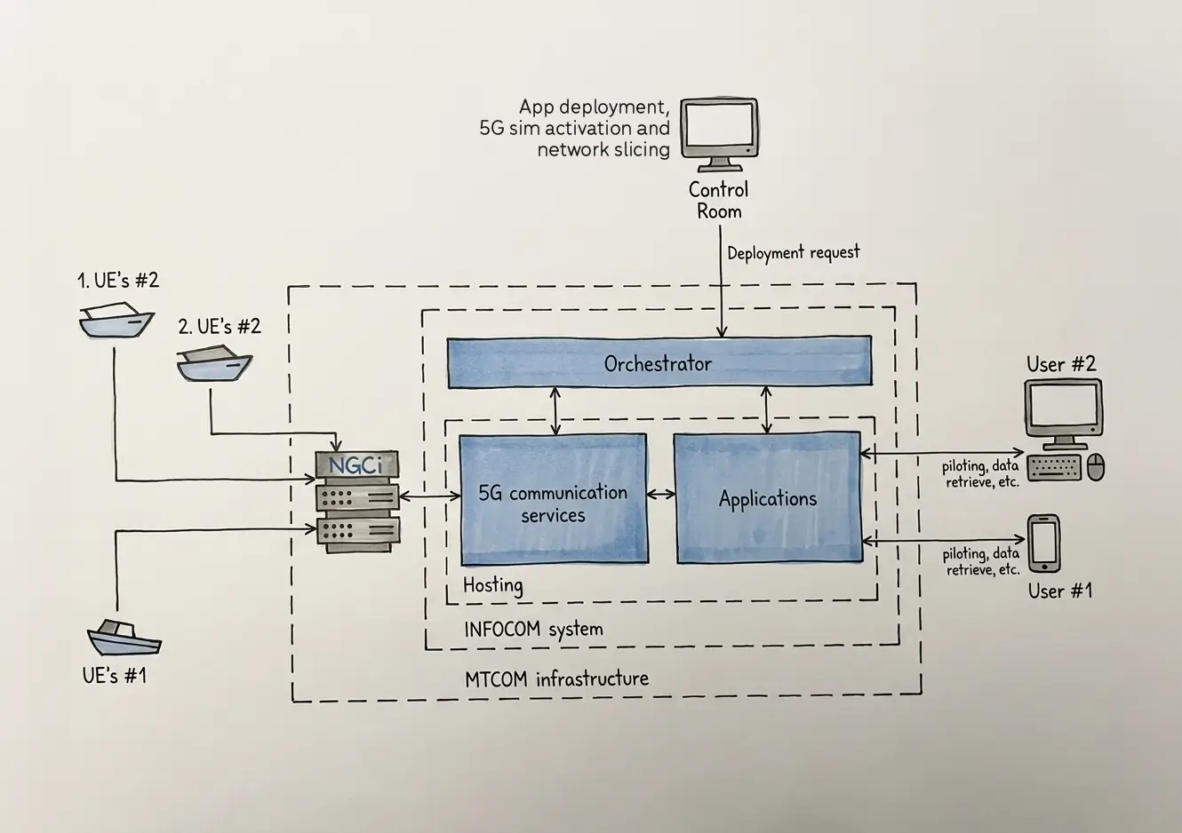
At a high level, we were responsible for the orchestration layer of the system, you could think of it as the ‘brain’ of MTCOM. It hosts all the applications and communication services needed to interact with the drones and enable functionalities such as monitoring, video streaming, navigation, and more.
The ‘brain’ runs on our server and, of course, it's connected to SMA-RTY’s 5G network (NGCI – Next-Generation Communication Infrastructure), which acts like the system’s ‘nervous system’. Through this, the drones can operate in real time, performing coastal monitoring and other tasks.
So basically, our main task was to develop a user-friendly dashboard that allows fast configuration and automation of both application and communication services deployment, making the entire system easy to manage.
Mmm, can you explain more to me? What does it mean in practice?
Sure, let's break it down starting from application deployment. In practice, this means installing the applications developed by SITEP (Ed. another partner from MTCOM) on our servers so that the drones and NGCI can use some of their functionalities.
Each application has specific requirements. To manage these, we create a command file to instruct the system to automatically perform all the necessary steps: preparing the environment, installing software components, assigning resources, and ensuring everything starts in the correct order.
You can think of this process like a hotel reception assigning each guest to the right room according to their needs.
Does this make sense so far?
Clear enough! And once the application is deployed, what happens next?
Once deployed, the application keeps running continuously. You don’t need to repeat the process unless there are updates or changes, such as adding new sensors. From that point on, the system mainly handles communication between its components.
How does communication between components work?
The orchestration system on our servers communicates with the NGCI Core Network. Through the dashboard, operators can activate the SIMs installed on the drones (or other equipment) and assign them to specific network slices for optimized performance.
This allows drones to connect to the system and access all functionalities provided by the deployed applications.
How do drones interwork with the applications deployed on the centralized servers?
To put it simply, the drone, via its 5G SIM, communicates through antennas with the NGCI radio base stations. These stations are linked via a cabled IP network to Infocom’s server, which hosts SITEP’s applications.
Through this setup, the drone exchanges data with the applications, allowing operators to remotely pilot it and monitor data from its onboard sensors.
Got this, I heard you also mentioning "network slices". What are they?
5G allows the network to be virtually divided into segments optimized for different services. For example, one slice can provide low latency for remote drone piloting, while another is optimized for sensor data transmission.
Each UE (User Equipment) is assigned to the most suitable slice, ensuring efficient and reliable communication.
And can all of this be managed easily?
Yes, indeed. We developed a dashboard that allows operators to control everything in a simple way. Through this interface, they can deploy applications, activate SIMs for the drones, and associate them with the appropriate 5G slices.
The system handles the complexity in the background, so operations can be performed in just a few steps.
How was the experience of working on MTCOM?
From a design perspective, it wasn’t particularly challenging for us, as it builds on technologies we already know well. However, what made the project valuable was seeing our solutions applied in a real operational context.
The project gave us the opportunity to connect our technical expertise with real-world needs. Seeing drones, software, and 5G connectivity working together in a live environment was very rewarding.
It demonstrated how a scalable and automated infrastructure can support multiple applications, from coastal monitoring to infrastructure surveillance.