
5G at Sea: solving offshore connectivity challenges
A six-metre fishing boat doesn't transmit an AIS signal. It isn't required to, and in many cases it simply doesn't. To a coastal radar, that boat effectively doesn't exist, unless it passes close enough to be seen, literally, by eye. It's a gap that has always existed in maritime surveillance, but it matters more today: sea traffic has grown enormously over the past thirty years, while the tools used to monitor it, radar, VTS systems, AIS, are largely the same ones designed decades ago.
The result is an architecture full of blind spots: small vessels below the radar threshold, identification systems that can be switched off at will, stretches of sea where no signal useful to whoever is monitoring a port or a coastline actually arrives.
Why communication at sea is so hard
It isn't just a matter of missing sensors. The sea is a hostile environment even for those who already have connectivity: the water's surface refracts electromagnetic waves, weather conditions shift quickly, distances are long. On top of that, traffic itself adds noise, more vessels means more overlapping signals interfering with each other, right when network reliability matters most..
That's the problem we work on with MTCOM, our private 5G network infrastructure designed for the maritime environment. The starting point wasn't adding more antennas, but rethinking how a cell adapts to the interference patterns typical of the sea, correcting them in real time to keep the connection stable even several kilometres from shore..
The system has been tested in the port of La Spezia, and it's designed with coastal surveillance, pollution monitoring, and marine biodiversity protection in mind, via surface drones patrolling the water while staying connected to a shore-based command centre. .
Those use cases are the direction the system is built for; a permanent deployment hasn't been installed yet.
Beyond the coast: where MARGUS comes in
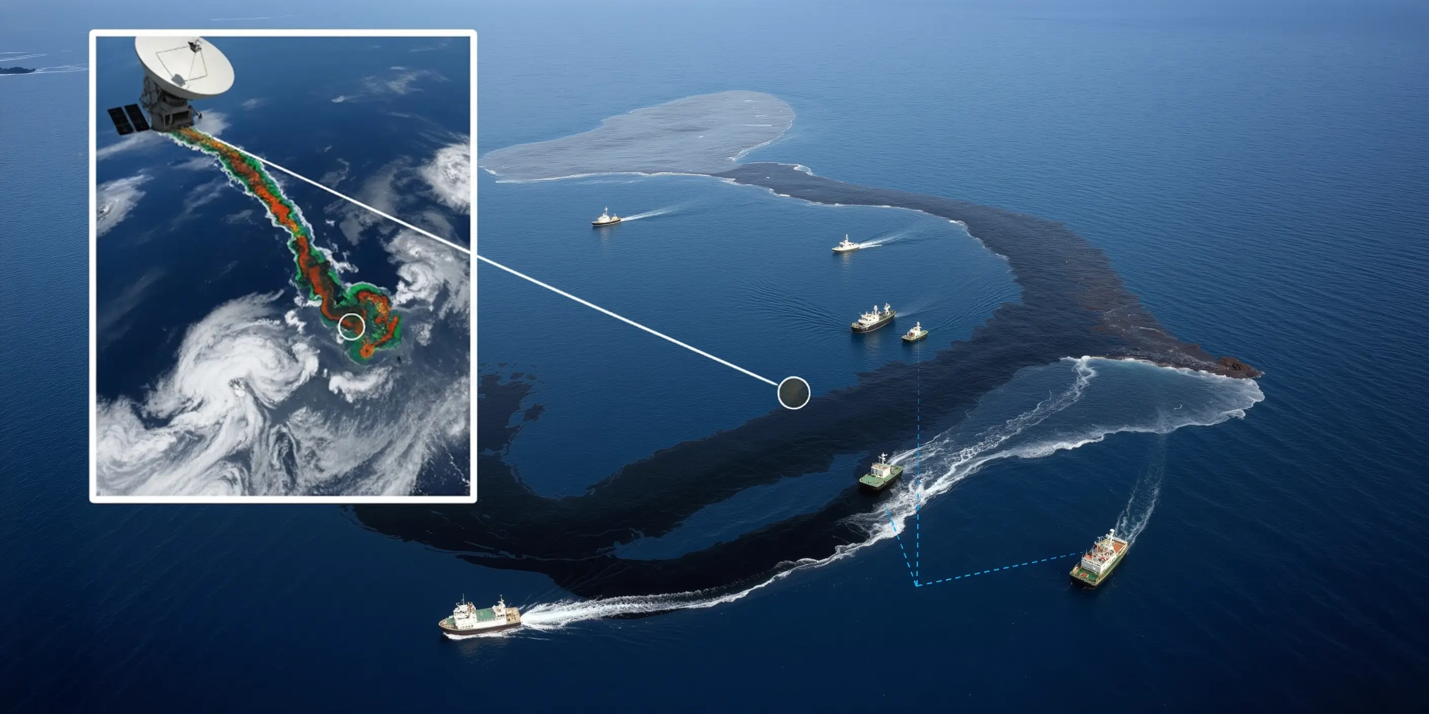
MTCOM covers the coastal band. But risks like an oil spill can also occur further offshore, in areas where traditional surveillance rarely reaches. .
That's the problem behind MARGUS: a project still in early development, not a system already validated in the field, aimed at combining satellite Earth observation data, AI, and autonomous surface drones to detect anomalies in open water before they become emergencies, then route a targeted human response once a threat has been classified.
Networks that don't need a centre
There's a third problem, less visible but just as concrete: how do you get drones, sensors, and autonomous systems to talk to each other when there's no fixed infrastructure to rely on, or when a node, a drone moving out of range, a sensor temporarily unreachable: drops out of coverage?.
Mesh networks, which we're currently working on as part of NATO and PNRR projects for the maritime domain, address exactly this: every node can relay information for the others, and if one link goes down, data automatically finds an alternative path..
Last October, during NATO exercise SHINE in Istanbul, our NGCI infrastructure connected underwater, surface, aerial, and ground systems into a single private 5G network, to simulate exactly this kind of scenario.
An ongoing challenge for sea security
None of these three layers, MTCOM, MARGUS, mesh networks, closes the maritime surveillance gap on its own. It's ongoing work, one piece at a time, and one that La Repubblica recently covered.
SMA-RTY designs private network infrastructure for complex operational environments, from the sea to industry.